Image View Software Package (Technical Approval of Software No. 205465)
A tool for preparing snow cover and vegetation cover maps, using TERRA and NOAA satellite images.
Specifications:
1- It is designed on an integrated geographic database and is applicable

2- Under network and support of images and maps database server
3- Saves initial images, results of the middle raster and final raster of the processing on geographic database map server.
4- Automatic land referencing of images of the NOAA, TERRA and AQUA satellites, using location information inside the image file
5- Feature of Two-stage threshold processing of AVHRR sensor NOAA satellite group from 11 to 19 for obtaining snow cover with PX 1km
6- Single-stage threshold processing of MODIS sensor of satellite TERRA, to obtain snow cover with PX 250-meter.
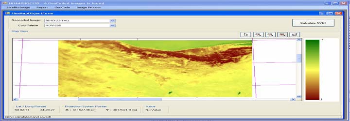
7- Computational processing of NDVI greenness index, using AVHRR sensor of NOAA satellites group and MODIS sensor of TERRA satellite.
8- Export Raster maps of middle and final results in RS software format.
9- Produce a composite report of the results and maps inside the database, in print and video file
10- Image file of TERRA satellite MODIS sensor for 200 selected dates from 27/04/2001 to 22/08/2009, which is available in the company's archive.
11- Image file of NOAA satellite AVHRR sensor for 1000 selected dates from 08/12/1988 to 22/08/2009, which is available in the company's archive.
The following sub-systems make up the main components of the Image View software.
1- Display and save the image files of AVHRR sensor NOAA satellite and MODIS sensor TERRA satellite
2- Reconstruction and storage of geo referenced images from raw satellite image, for the range and coordinate system of user choice along with registering the image by geo reference points
3- Calculates and saves the mid-layers of threshold processing, and saves the parameters by user choice
4- Calculates and saves the final layers of threshold processing, and saves the parameters by user choice
5- Calculates and saves the processing layers of indexes
6- Statistical calculations of Raster maps data for polygon objects, defined in database
7- Creates report from results of computational layers for printing and image files
