Climate View software package (Technical Software Approval No. 203439)
A tool for mapping and monitoring weather informationSpecifications:
1- It is designed on an integrated geographic database and is applicable.
2- Under network and support of database server of time series, models, images and maps
3- Raster map calculation of numerical value of meteorological parameters on user choice in stations, by altitude gradient method based on the vertical numerical model map.
4- Performs necessary corrections in the calculated raster maps based on altitude gradient, using the spatial distribution of calculated error in the meteorological observation stations.
5- Uses a variety of regression relations between station's meteorological parameters and characteristics, such as linear relations, exponential relations and logarithmic relations in the calculation of the Raster map.
6- Save all stages and assumptions and results of meteorological computational maps, by method of altitude gradient and corrected altitude gradient in the water resources database.
7- Prepares Raster maps for groundwater observing parameters used by geo statistics in water resources.
8- Saves all steps and assumptions and results of groundwater computational maps by common methods of geo statistics in the water resources database.
9- Computes statistical indices (average, minimum and maximum) of calculated raster maps for each of the areas defined in the geographic database.
10- Defines, saves and recovers dynamic map report of combination of raster map and vector maps from storage of the geographic database.
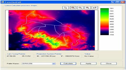
11- Defines, saves and prepares the computational raster maps, using user-defined relations in macro and in VB script language, in the geographic database environment.
12- Prints and prepares reports from computational raster maps along with vector maps stored in the database
The following sub-systems are the main components of Climate View software:
1- Geographic Information Management System

2- Map Information Management System
3- System for entering and changing time series information
4- Dynamic reporting system (time series)
5- System for management and production of a map report
6- Management of geographic coordinate Systems
7- Spatial distribution system of climatic information based on altitude gradient relations
8- Spatial distribution system of groundwater data based on geo statistics models
9 - Dynamic reporting system for GIS
10- Computational system of raster layers in GIS
