

Image View
A tool for extracting snow cover, vegetation cover, and cloud cover maps from MODIS and NOAA satellite imagery.
Image View software processes raw satellite imagery and provides analyzed and ready-to-use maps of snow cover, vegetation cover, and cloud cover.
Key Attributes
Support for NOAA (AVHRR) and MODIS satellites with varying spatial resolutions (from 250 meters to 1.1 kilometers).
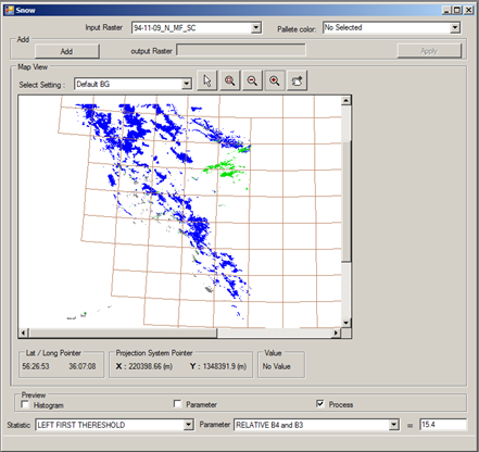
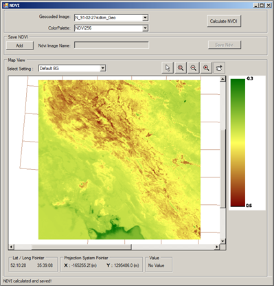
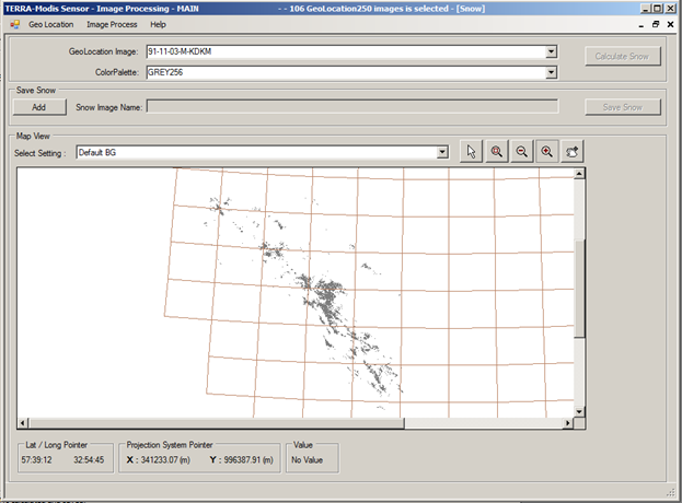
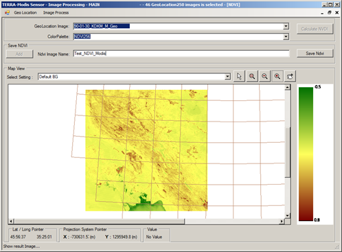
Automated, step-by-step extraction of snow cover, vegetation cover, and cloud cover using spectral thresholding methods.
Processing of raw and geocoded images and storing them in a database for future use.
Ability to define custom spatial boundaries for land cover analysis.
Applicable in climate monitoring and water resources management using up-to-date and continuous data.
A simple and reliable user interface for performing image processing operations.
Low data volume of NOAA imagery enables efficient archiving and fast processing, while MODIS imagery is utilized for higher accuracy.
Technical Architecture:
This software is developed in C# within the .NET Framework environment, designed with a multi-layer architecture, and utilizes local databases.
Operational Logic:
The operational framework of the Image View software is based on acquiring raw satellite imagery from NOAA and MODIS sensors, performing preprocessing steps such as geocoding, and subsequently applying spectral thresholding algorithms to distinguish land surface features such as snow, vegetation, and clouds. In this process, by analyzing spectral reflectance values, brightness temperature, and ratios between different bands, general features are first separated from one another, and then, using user-defined thresholds, surface cover layers are generated as classified maps. All processing stages, from raw imagery to final results, are stored in the database and can be retrieved and analyzed for future studies.
Why Image View?
Customizable and Adaptable to Regional Needs
Algorithms and software structure are designed to match environmental data and climatic conditions of the target region.
Dual Satellite Support (MODIS and NOAA)
Flexibility to choose between high-resolution MODIS imagery or lower-volume NOAA imagery, depending on project requirements.
Step-by-Step, User-Controlled Processing
Accurate separation of snow, cloud, and vegetation cover through adjustable spectral thresholding methods.
Structured Database Storage
Raw, geocoded, and processed data are stored in a structured database, ensuring easy retrieval for future analyses.
User-Friendly Interface
A simple and intuitive graphical interface makes the software accessible for both technical and non-technical users.
Integration with Other Analytical Tools
Seamless connection with companion applications such as Climate View and Flood View for complementary analysis and comprehensive decision-making.
Software Workflow Cycle
- Satellite Data Acquisition – Importing NOAA or MODIS satellite imagery by the user.
- Geocoding – Aligning imagery with precise geographic coordinates.
- Initial Feature Separation – Applying thresholding techniques to distinguish land, snow, and cloud cover.
- Refined Classification – Separating snow from clouds and vegetation using spectral parameters.
- Map Generation – Producing final maps of snow, vegetation, and cloud cover.
- Structured Data Storage – Archiving all processing stages in a structured database for future retrieval and analysis.
Organizations That Could Benefit from Image View
- Regional Water Authorities
- Water Resources Management Organizations
- Consulting Firms in Water and Environmental Fields
- Academic Researchers
Conclusion
Image View software provides a complete framework for acquiring, processing, and analyzing satellite imagery. It is a precise, independent, and adaptable tool for extracting maps of snow, vegetation, and cloud cover. Designed for use in climate monitoring, water resource management, and environmental analysis, it serves the needs of specialized organizations, research institutions, and executive agencies worldwide.